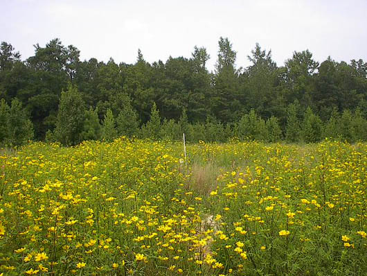
The Flint River at the
County Line Road Site
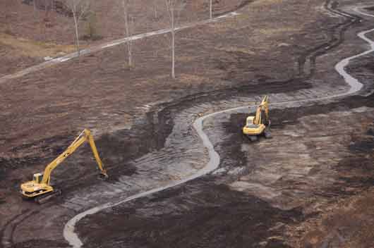
County Line Road
Mitigation Site in Spring
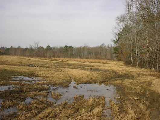
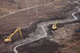
County Line Road
Under Construction
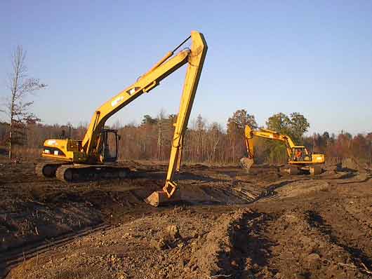
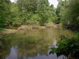
Town CreeK
Stream Construction

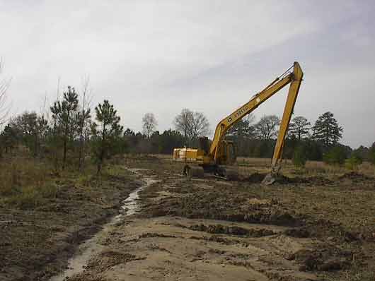
Town Creek Site
Under Construction
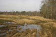
County Line Road
After Construction
Mitigation Project Experience
Stonecrest Mall Mitigation Site, Rockdale County, Georgia (~1 acre).
The mitigation area consists of stream and riparian restoration along an unnamed tributary to Honey Creek. Completed February 24, 2009.
 Brent Scarbrough & Company was chosen to restore an unnamed, degraded tributary to Honey Creek to compensate for authorized impacts incurred as a result of the Stonecrest Mall development. Historic channelization and straightening caused the tributary to incise and degrade water quality through streambank erosion. The degraded stream was rerouted and graded in accordance with a natural channel design prepared by Ecological Solutions, Inc. The original alignment was abandoned and the new stream channel was precisely graded with stable dimensions, pattern, and profile for approximately 750 linear feet. A total of nine step-pool rock weirs were installed to attenuate flows along steeper slopes and diversify streambed habitat. Project constraints included a very narrow construction corridor, inclement weather, protection of numerous large trees, and an aerial sewer line crossing
Barnett Farms Mitigation Bank (10,283 linear feet)
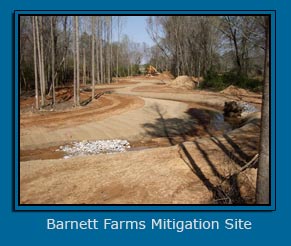 The Barnett Farms Mitigation Bank (BFMB) consists of approximately 65 acres of stream and adjacent riparian habitats and is located northwest of the City of Pine Mountain in Troup County, Georgia. The primary goal of the BFMB is to restore and enhance small headwater streams and their associated riparian buffers in order to generate stream credits within the Middle Chattahoochee, Upper Tallapoosa, Upper Chattahoochee, and Flint River Basins. Stream restoration will include approximately 10,283 linear feet of Priorities 1 and/or 2 restoration along Polecat Creek and Streams 1 through 4. Impounded and degraded reaches will also be restored into constructed channels designed to maintain stable channel dimensions, patterns, and profiles. Riparian restoration will be conducted within areas of the buffer that consist of pasture and those areas that are currently inundated by farm ponds. The BFMB is currently under construction, and riparian planting will occur after channel restoration reaches have been constructed.
Camp Creek Restoration: Near Bethsaida Road
Linear Feet Restored - Approximately 2,432
Completed in December 2008
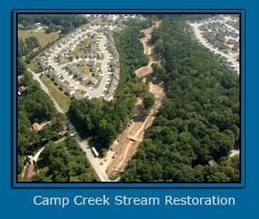 With proposal assistance from Ecological Solutions, Inc., Brent Scarbrough & Company was awarded the contract to construct approximately 2,432 linear feet of Priority 2 stream restoration along a portion of Camp Creek in Clayton County, Georgia. The preexisting channel of Camp Creek was incised and actively eroding as a result of increased impervious surface within its 5 square mile watershed. CCWA's Water Resources Initiative 2000 seeks to restore degraded stream reaches to improve water quality within the county through natural channel restoration that reduces sedimentation. Restoration of Camp Creek consisted of rerouting the channel and excavating bankfull benches to reestablish a natural hydrologic regime and to provide a flood-prone area to reduce stream power and erosive conditions. Rosgen-based in-stream rock cross-vanes, j-hook vanes, and log sills were constructed to provide grade control and convey flow away from streambanks. Coffer dams and by-pass pumping sequences were employed to allow construction during dry conditions to prevent sediment mobilization. Bioengineered materials and structures such as woven coir fabric and soil encapsulated lifts were installed to stabilize streambanks and reduce erosion until vegetation becomes fully established. Curvature Landscapes installed native live stakes, trees, and shrubs within the restoration corridor to jumpstart a climactic riparian vegetative composition. Brent Scarbrough & Company has exceeded the expectations of the CCWA and CH2M Hill during this project.
Project - Camp Creek Restoration: Near Bethsaida Road
Client Clayton County Water Authority (CCWA)
Project Manager Mike Buffington, CCWA
Project Design Consultant - Phillip Sacco, CH2M Hill
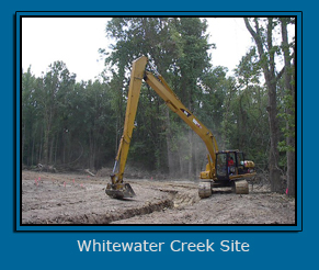 Whitewater Creek Mitigation Site, Fayette County, Georgia (53.4 acres)
The mitigation area represents wetland restoration, enhancement and preservation along with stream restoration and preservation.
Completed in June 2007
The Whitewater Creek mitigation site is part of the Flint River Mitigation Bank and totals approximately 53.4 acres and is located in Fayette County, Georgia. Construction work included filling old agricultural ditches used to drain the area and removing a berm that previously served to keep water from entering the floodplain. Approximately 2,000 linear feet of Priority 1 stream restoration was constructed to reroute and meander a stream with a natural channel design through the floodplain. Previously the stream was confined to a straightened ditch that was unable to overflow it’s banks.
Town Creek Mitigation Site, Macon County, Georgia (700 acres) Grading wetland enhancement and preservation, stream restoration, riparian restoration and preservation, and upland buffer/inclusion preservation
Completed in December 2006 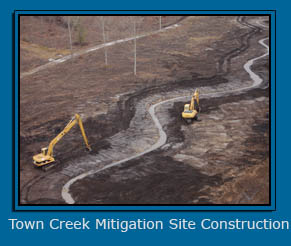
Prior to restoration activities the Flint River (Town Creek) Site, located approximately 5.0 miles northwest of Montezuma Georgia in the Flint River floodplain, was composed primarily of immature forest with portions of mature bottomland hardwood forest. Mitigation activities included grading portions of a logging road that bisected the wetland area to allow for increased connection of wetland flows and replanting clear-cut areas with native oaks and gums. Approximately 1.4 miles of relict stream channel was restored to its historic flow path and stabilized after construction using vegetation and fabric. The constructed stream channel was designed using Rosgen-based principles to maintain stable stream geometry. The Town Creek Site was designed and is currently being monitored and maintained by Ecological Solutions Inc.
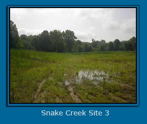
Snake Creek Mitigation Site, Carroll County, Georgia (Total 94 acres)
Grading Wetland Construction, Enhancement and Restoration and Stream Restoration Completed February 2003
Carroll County Water Authority contracted us to conduct mitigation activities such as wetland enhancement, restoration, and creation on three mitigation sites located in the Snake Creek watershed.
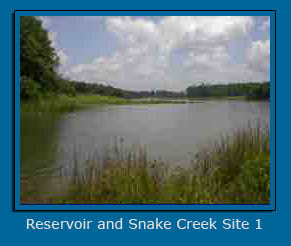 Site 1 (8.1-acres) - The Guthrie Creek mitigation site is located within the floodplain of three small streams that feed into the recently constructed 660-acre Snake Creek Reservoir. Two existing fallow agricultural fields that had been ditched to drain the area for agriculture were excavated down to construct wetlands and several small earthen berms were constructed in the open fields to disperse water throughout the area. Roadside runoff ditches were diverted into the wetland mitigation area to improve the quality of water discharging into the reservoir. The excess cut material from excavation was used to create a shallow plateau within the reservoir so that a littoral-shelf-wetland will be created once full pool in the reservoir is achieved. In addition, rock cross vane structures were placed in the streams to provide stability and promote overbank flooding during storm events. The Guthrie Creek Site was designed and is currently being monitored and maintained by Ecological Solutions Inc.
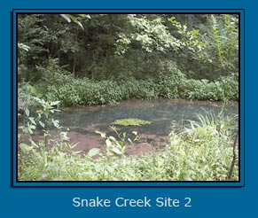 Site 2 (22.9-acres) - The Cross Plains Road mitigation area is located in the Snake Creek floodplain, upstream of the Snake Creek Reservoir. The ditches that once drained the area for agriculture were filled to restore wetland hydrology and check dams were installed in the small, degraded streams to increase the frequency of overbank flooding in adjacent floodplain areas. Chinese privet, a non-native plant species, was also removed from the restoration area. The Cross Plains Site was designed and is currently being monitored and maintained by Ecological Solutions Inc.
 Site 3 (63.3-acres) - The Wellington Mill Road mitigation area, previously a sand and gravel excavation operation, is in the Snake Creek floodplain downstream of the reservoir. Portions of this site were excavated several feet to create wetlands at the same elevation as a large scrub-shrub/emergent beaver swamp that was already established on the site. The Wellington Mill Site was designed and is currently being monitored and maintained by Ecological Solutions Inc.
Client: Carroll County Water Authority
Project Manager: Mr. Matt Windom (770) 834-6667
Flint River ( County Line Road) Mitigation Site, Fayette County, Georgia (86 acres) Grading completed in 2002 Wetland Restoration, Enhancement and Preservation and Stream Preservation
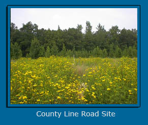 The Flint River mitigation site is located in the Flint River floodplain approximately 4.0 miles east of Fayetteville, Georgia. The restoration practices implemented to transform the large, cleared, ditched pasture into a maturing forested wetland included filling ditches, excavating several shallow ponds and replanting the area with native wetland vegetation. An old road bed was removed in a forested portion of the site along the Flint River to allow for increased connection of overbank flows. The site is located within a high growth area and the upland area is slated for a residential subdivision. Ecological Solutions, Inc. provided the design, banking instrument, monitoring and maintainence for the County Line Road site of the Flint River Mitigation Bank.
Snapping Shoals Wetland Mitigation Project (25 acres)
Wetland Enhancement and Stream Restoration
Completed in October 1999
This project is located in the Camp Creek floodplain in Rockdale County. This project involved the installation of rock check dams, gabion structures and ditch filling.
Contact: Mr. Ray Hodges, Rockdale County (770) 761-4506
Deerfield Park Wetland Mitigation Project, Fulton County, Georgia (25 acres)
Wetland and Stream Restoration
Completed in May 2000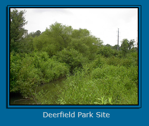
This project was constructed in phases over a 2-year period due to the ongoing permitting needs of the client. The Deerfield Park site, previously a golf driving range, is located in the floodplain of Camp Creek in North Fulton County. This project involved the installation of rock check dams and gabion structures to stabilize the onsite streams. The contractor was also required to fill ditches and construct several small berms with rock check dams to restore wetland hydrology in the floodplain. Current Members of Ecological Solutions, Inc. staff were involved in the mitigation design of the Deerfield Park project.
Contact: Ms. Mary Hines, Hines Development (770) 206-5300
Yellow Creek Wetland Mitigation Project, Dawson County, Georgia (30 acres) Wetland Creation
Completed in February 1998
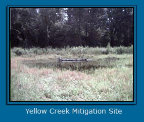 This project, located in the Yellow Creek floodplain, created wetlands by constructing berms to retain water in wetland cells. The clay necessary to build the berms up to specification had to be moved from another portion of the site; this project involved large-scale earth moving and took 2 months to construct during the wettest time of the year. Because of the sites location near streams that provide habitat to threatened fish species, erosion and sediment control devices were strictly maintained during these construction activities. In addition to these difficulties, access to some portions of the site was poor, so rock and other supplies had to be creatively staged. Ultimately the drainage ditches were filled, the rock check dams and diversion structures were installed and wetlands were successfully created. Current members of Ecological Solutions, Inc. staff were instrumental in the mitigation design and construction monitoring of this project.
Contact: Mr. Tom Latham, Cherokee County
Mountain Creek - City of Monroe Reservoir, Walton County, Georgia
Wetland Creation - Completed in February 1999
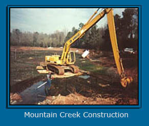 Prior to restoration, Mountain Creek flowed along the wall of an abandoned wastewater treatment lagoon that had been drained. Mountain Creek was diverted into the abandoned lagoon by means of gabion structures that diverted a portion of the flow from Mountain Creek into the lagoon. Portions of the berms that cover the sewer pipes that transect the lagoon were graded to allow water to flow freely through the cells and under the sewer pipes. The water exited the created wetland system through an outfall gabion structure into the original channel of Mountain Creek. Extra precautions for erosion and sediment control were taken so that raw wastewater did not leave the site during construction. This project involved the most complex grading to date and took nearly 2 months to construct. All structures were inspected recently and were, for the most part, functioning properly. Several members of the Ecological Solutions staff were involved in the mitigation design, construction monitoring and long-term monitoring of this site.
Contact: Mr. Billy Dial, Monroe City Manager, Walton County (770) 267-7536
Wolf Creek – City of Monroe Reservoir, Walton County, Georgia (35 acres)
Wetland and Stream Restoration - Completed in March 1999
The Wolf Creek site consisted of pasture land that had been previously converted from wetland. The site was extremely wet in areas due to beaver impoundments; the construction of the site took 3 weeks to complete during the wet time of the year. Ditches were filled throughout the floodplain and large earthen berms were constructed within the future reservoir pool to provide wildlife habitat and areas for trees to grow. A rock check device was installed in Wolf creek and total of 40 large river birch trees were planted in the floodplain by Scarbrough’s crews. A recent site inspection found the structures to be in excellent condition. Several members of the Ecological Solutions staff were involved in the mitigation design, construction monitoring and long-term monitoring of this site.
Contact: Mr. Billy Dial, Monroe City Manager, Walton County (770) 267-7536
Winfield Creek Wetland and Stream Mitigation Project
Stream Restoration - Completed in February 1997
Historically, Winfield Creek was severely channelized to drain the floodplain for agricultural purposes. Originally, restoration along Winfield Creek was performed by another contractor, but the structures were destroyed during Hurricane Opal. Gabion structures were installed in the bed of the stream to increase the width to depth ratio. A recent site inspection found the structures working properly with no problems. Several members of the Ecological Solutions staff were involved in the mitigation design, construction monitoring and long-term monitoring of this site. Contact: Ms. Carrie Belbeck, Rockdale County (706) 918-653
Brooks-Flint River Mitigation Site (60 acres) - Completed in March 1995
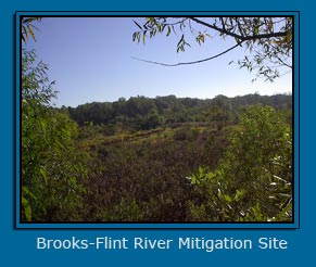 This project was for the Fayette County Reservoir ( Lake Horton) and is located in the town of Brooks and adjacent to the Flint River. Ditches were filled and gabion devices were placed within two deeply incised stream channels. Small vernal pools were also constructed within the floodplain to provide for diversity and habitat for frogs and salamanders. Riparian buffers were replanted with native hardwood species to jump start the vegetation on the site. Several members of the Ecological Solutions, Inc. staff were involved in the mitigation design, construction monitoring and long-term monitoring of this site. Fayette County Project Manager and reference: Tony Parrott (770) 461-2223.
Reeves Creek Wetland Mitigation Project, Henry County, Georgia (60 Acres)
Wetland Restoration - Completed in October 1994
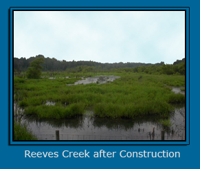 Located in the Reeves Creek floodplain, this project involved large scale earth moving to fill large ditches and create 3 acres of wetland ponds. The earth moving effort took 4 weeks to complete was hampered by soils that were not suitable to transport heavy equipment; these difficulties were overcome by the use of tracks and 4 wheel drive dump trucks. Rock check dams and diversion structures were installed to maintain high standards of erosion and sediment control. This site has been called the best wetland mitigation site in the metro Atlanta area by Mr. Butch Register, former Chief of the North Section – Army Corps of Engineers, Atlanta, Georgia. Several members of the Ecological Solutions staff were involved in the mitigation design, construction monitoring and long-term monitoring of this site. Contact: Mr. Bill McNally, Henry County (770) 461-2223
In need of Wetland or Stream Mitigation,
Construction, or Grading Please Contact:
Mr. Frank James
Fayetteville, Georgia
404.456.3380
email
![]()


![]()
![]()